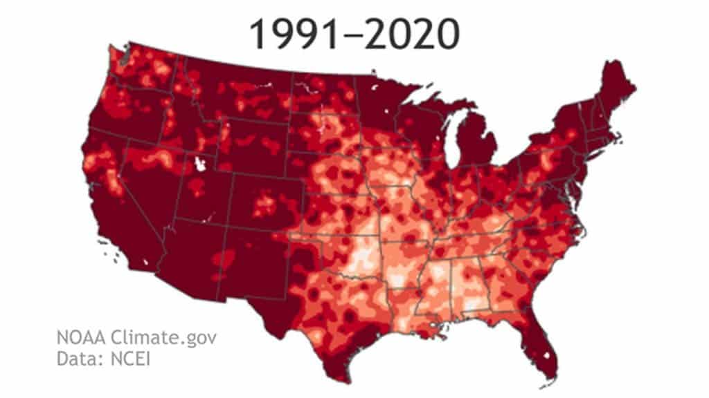
Every 10 years, the National Oceanic and Atmospheric Administration (NOAA) releases an analysis of the weather in the US over the past three decades. To absolutely no one’s surprise, the past decade has been hotter and wetter than any other in recorded history — by a mile.

In its report, NOAA looked at the weather from 1991 to 2020 and calculated average values for temperature, rainfall, and other conditions, using information from 9,000 daily reporting stations. NOAA refers to these averages as the “climate normal” and well, this normal isn’t looking normal at all.
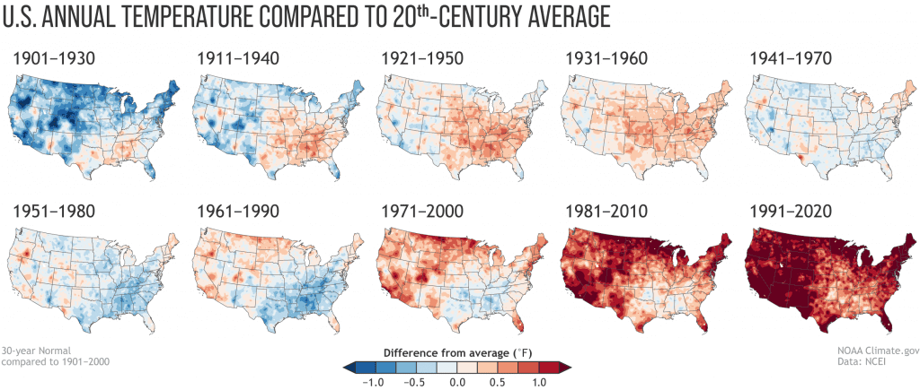
The US has warmed 1.7 degrees (1 degree Celsius) since 1901-1930, the first period for which climate normal were calculated. That’s in line with the global rate of warming over that period. Still, the US was behind the world’s average until recently. The country has seen its biggest jump in temperatures during the last two 30-year periods.
“We’re really seeing the fingerprints of climate change in the new normals,” Michael Palecki, manager of NOAA’s effort to update the climate normals, said at an April news conference, in anticipation of the new report. “We’re not trying to hide that. We’re in fact reflecting that.”
Over the entire country, the yearly normal temperature is now 53.3 degrees (11.8 degrees Celsius). Twenty years ago, it was 52.3 degrees (11.3 degrees Celsius) based on data from 1971 to 2000. The new normal annual U.S. temperature is 1.7 degrees (0.9 Celsius) hotter than the first normal calculated for 1901 to 1930.

Temperatures dropped slightly for 1991-2020 compared with 1981-2010 across a part of the north-central United States. Still, more than 90% of the U.S. has warmer normal temperatures now than 10 years ago. The US map is getting redder and redder.
Charlottesville, Virginia, saw the biggest jump in normal temperatures among 739 major weather stations. Other large changes were in California, Texas, Virginia, Indiana, Arizona, Oregon, Arkansas, Maryland, Florida, North Carolina, and Alaska. In Chicago, the new yearly normal temperature rose 1.5 degrees (0.8 Celcius) in the last decade.
Not just warmer — also wetter
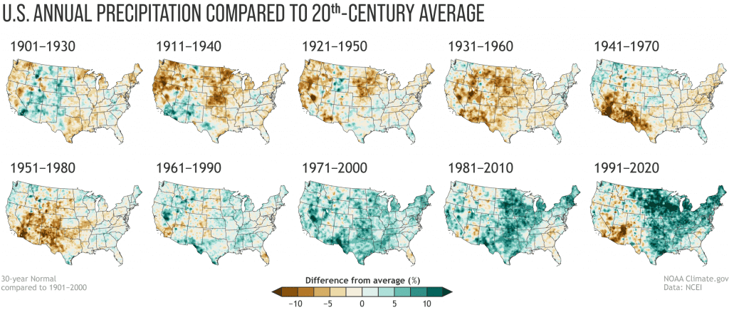
The new normal shows not just in higher temperatures, but also in more precipitation. NOAA’s data estimated a national precipitation average of 31.31 inches for 1991-2020. This is 0.34 inches higher compared to the 1981-2010 value of 30.97 inches. The 20th-century average was 29.94 inches.
Speaking with the Washington Post, Palecky said most of the US has been turning into a “much wetter environment”, quoting NOAA’s data. Still, precipitation trends vary by region more than temperature. Between 1981-2010 and 1991-2020, it turned wetter across much of the eastern two-thirds of the nation but drier across most of the southwest.
It’s probably not a coincidence that the last four maps in the series — the 1961-1990, 1971-2000, 1981-2010 and 1991-2020 Normals — are nationally the four wettest maps in the collection.
At least some of that wetness relative to the 20th-century average is linked to the overall climate warming, NOAA explained.

Large parts of the US are expected to get even wetter over time, especially the northern states, because of climate change. However, rainfall and snowfall appear to be trending toward clusters of intensified precipitation, separated in some cases by longer dry periods. Plus, there are signs of a megadrought over the southwest United States.
“What we’re trying to do with climate normals is to put today’s weather in a proper context so we understand whether we’re above normal or below normal and also we’re trying to understand today’s climate so people know what to expect,” Palecki told the Washington Post.
Once published, NOAA’s reports come in handy for many across the country, enabling policymakers to prepare mitigation measures (should they so desire). Weathercasters also call on the values to tell how a day’s temperatures compare to the norm for that calendar date, state regulators use climate averages when setting rates for the electricity and natural gas and farmers can plan what to plant and when.
Still, climate change is hard to quantify. Increases in greenhouse gas emissions might mean that the 30-year average doesn’t capture the true likelihood of a given temperature right now, and this small difference can have a big effect on the interests of utilities, where temperature increments can translate into big costs. Simply put, some days (or weeks) can still be abnormally cold or dry, even as the country as a whole is getting hotter and wetter.
That’s why NOAA is looking at new ways to report climate normal that might reflect more accurately what to expect in the 2020s. Researchers have suggested using climatological periods shorter than 30 years, for example. Following the advice, NOAA’s climate normal included a supplemental set of 15-year data for the period 2006-2020.


