Tornadoes are associated with the strongest and most violent storms, reaching winds of up to 300 miles per hour (480 km/h). Let’s take a look at what makes these storms twist and shout.
What tornadoes are
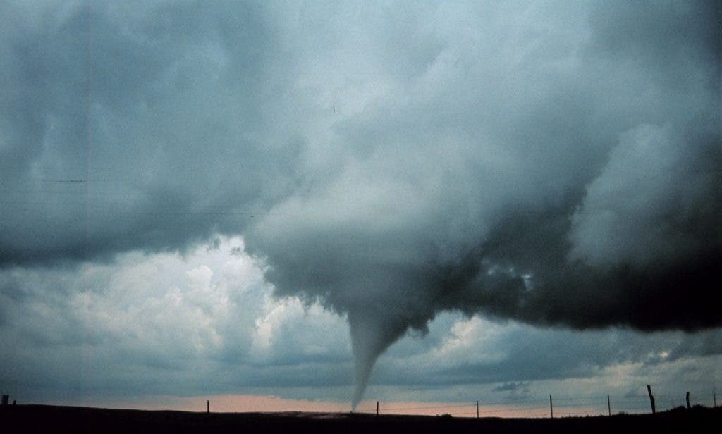
If you look at a tornado, you sort of intuitively know what it is – a mass of rapidly spinning air. The full formal definition from the Glossary of Meteorology is “a violently rotating column of air, in contact with the ground, either pendant from a cumuliform cloud or underneath a cumuliform cloud, and often (but not always) visible as a funnel cloud”. But the process that leads to its formation is maybe not so intuitive.
The formation of a tornado can be roughly divided into the following steps:
- Like most winds and storms, tornadoes start when the Sun heats the land, and subsequently the wind above it. Being warmer and therefore lighter, this wind starts to rise up, until it encounters a mass for colder air.
- As the two masses of air meet, wind sheer develops and they start to rotate around one another. As the faster air rotates around the slower air, it starts to pick up pace and speed. At this stage it’s only a horizontal wind.
- If it’s strong enough, the warmer wind starts to push the colder air higher and higher, creating an updraft. At this stage, a cylinder starts to develop.
- If the solar activity continues, more warm air starts to rise up and meets the updraft, making it bigger and bigger. If this continues long enough, the spinning wave create a vortex that has enough energy to power itself. At this stage, it’s a fully formed tornado, moving in the direction of the thunderstorm winds.
It’s a simple, but very specific set of steps that need to happen – almost like a ‘Goldilocks area’.
Most tornadoes last less than 30 minutes, but the big ones can last for much longer and spread over more than 1 kilometer. A tornado that struck Hallam, Nebraska in 2004 was up to 2.5 miles (4.0 km) wide at the ground, and a tornado in El Reno, Oklahoma in 2013 was approximately 2.6 miles (4.2 km) wide, the widest on record.
Appearance and types of tornadoes
As mentioned above, most tornadoes have the familiar funnel shape, but this is not always the case. Tornadoes can have a wide range of colors, depending on where they form. They can vary from nearly invisible to strongly marked, even by the debris they’re picking up.
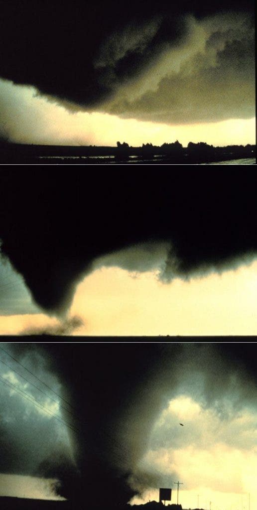
Lighting conditions are also important for the appearance of the tornado. A tornado which is “back-lit” (viewed with the sun behind it) appears very dark, but the same tornado viewed from a different angle can appear milky white. At one point considered a myth, there is now mounting evidence that most tornadoes have a clear, calm center with extremely low pressure, akin to the eye of tropical cyclones.
There is not an official classification of tornadoes, but rather several unofficial ones based on several characteristics.
- Super cell tornadoes are the most common and the most dangerous type. A supercell is a thunderstorm that is characterized by the presence of a mesocyclone.
- Non-super cell tornadoes are much rarer. They originate from from a vertically spinning parcel of air already occurring near the ground caused by wind shear from a warm, cold, or sea breeze front, or a dryline, according to NOAA.
Another type of classification refers to the type of spout. Aside for a “normal” tornado, you have:
- Multiple vortex – in which two or more columns of spinning air rotate around a common center. This is not a type of satellite tornado, which is a smaller tornado which forms very near a large tornado.
- Waterspout – a waterspout is officially defined as any tornado over water. Some waterspouts actually gather water in the vortex and spin it around.
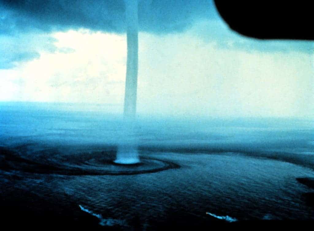
- Dust Devil – a tornado that is very weak and generally formed in the absence of clouds. They are not considered true tornadoes because they form during fair weather, but can cause massive damage.
- Fire Whirls – small-scale tornadoes can emerge in the vicinity of fires. They are not associated with thunderstorms but can cause massive damage, particularly because they spread fires.
- Steam Devils – like dust devils, steam devils sometime form in the desert, but they are very rare. They typically involve smoke issuing from a power plant’s smokestack.
Tornadoes can also be classified by impact, with F0 (or EF0) being the weakest one and F5 or (EF5) being the strongest.
Detecting and forecasting tornadoes
Starting in the 1950s, several attempts to detect and emit tornado warnings have been set up. Before that, the only way to spot a tornado was to actually see it on the ground.
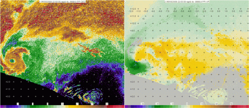
Today, not only do researchers know that tornado-generating storms have some defining characteristics, but we also have a myriad of satellite and radar data to help spot the storms. Computer programs analyze Doppler radar data and display it in ways that make it easier for forecasters to identify dangerous weather. Most countries have their own radar network to detect signatures associated with tornadoes
For example, a “hook echo” describes a pattern in radar reflectivity images that looks like a hook extending from the radar echo. This phenomenon is associated with a mesocyclone and indicates favorable conditions for tornado formation. This is just one of the phases meteorologists are monitoring for tornado detection – read more about that on NOAA.
Forecasting tornadoes is much more different than hurricanes, which are much larger, last longer and have more visible signatures. According to NOAA, the average amount of time between a tornado warning and the arrival of a storm is about 13 minutes. As computers become faster and models are improved we may get more warning time, but in the meantime, tornadoes are very difficult to forecast.
Staying Safe
Some tornadoes are simply off the charts. The largest recorded tornado in history is the so-called Tri-State Tornado, which roared through Missouri, Illinois and Indiana in 1925. It holds records for longest path length (219 miles, 352 km), longest duration (about 3.5 hours), and fastest forward speed for a significant tornado (73 mph, 117 km/h) anywhere on Earth. Most tornadoes are nowhere near that magnitude, but can still be very dangerous. Staying safe during a tornado is extremely important, and as it’s usually the case – being prepared is pretty much the best thing you can do.
Tornadoes often strike quickly, without warning, and can be difficult to spot. Therefore, if an area is susceptible to tornadoes, shelters should be set up and all families should have an emergency kit prepared, including water, canned food, a radio, garbage bags, pet food (if necessary), a first aid kit and so on.
If a shelter is not available, then there are three main things to keep in mind:
- if in a building, go straight to the basement (cellar) or the lowest floor if there is no basement. Stay in the center, away from walls, corners and windows, duck under a sturdy table and protect your head and neck with your arms if necessary
- if in a car or mobile home, don’t stay there! Go towards a sturdy building, and follow the steps above. Don’t try to outrun the tornado, that’s usually a very bad idea.
- if there is no building around and you are on foot, avoid overpasses and bridges where debris might gather. Flying debris cause the most fatalities and injuries, and your best bet is to lie flat in a nearby ditch or depression and cover your head with your hands.
A 2012 study of tornado injuries found that wearing a bike helmet or an American Football helmet is a very effective way to reduce injuries and even fatalities.
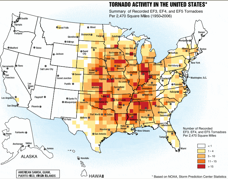
Tornadoes have been noticed on all continents except Antarctica. They can strike in urban or rural areas, and can do so without any warning. Tornadoes have been studied most in North America, where an estimated 1,200 strike the United States each year. Some states are more vulnerable than others – note the famous Tornado Alley, where tornadoes are quite frequent.
