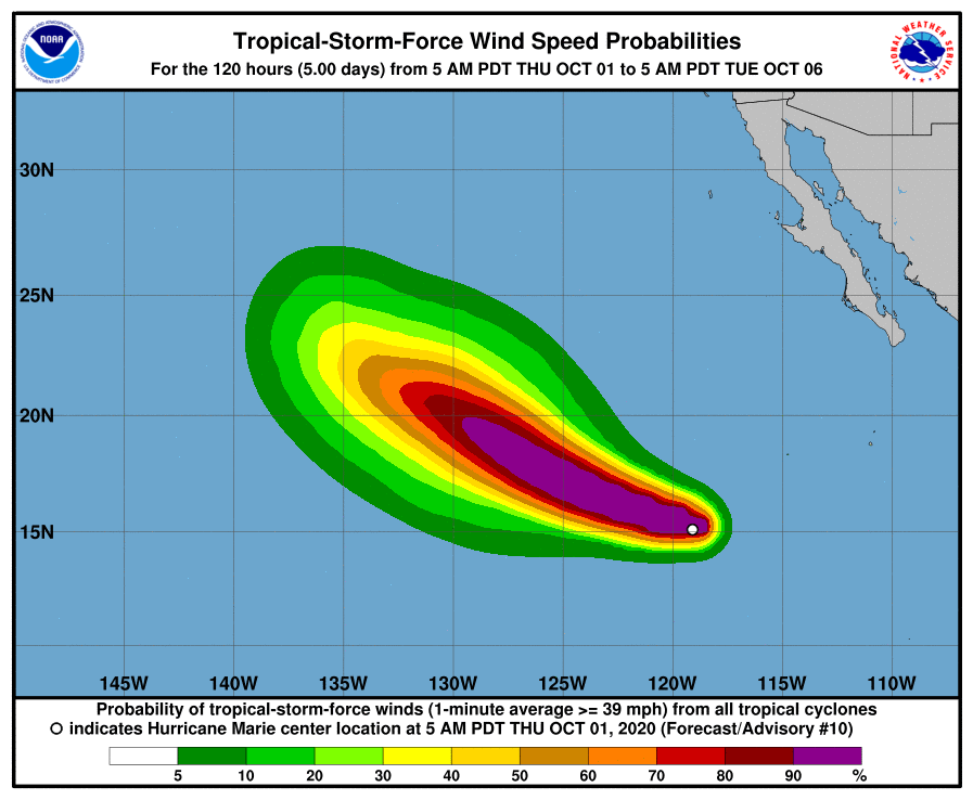
NASA announces that Hurricane Marie, off the Californian coast, is rapidly growing more intense.

Infrared images captured by the Agency’s satellites show that the hurricane’s eye is surrounded by massive thunderstorms as Marie makes its way through the Eastern Pacific. The National Oceanic and Atmospheric Administration’s National Hurricane Center (NOAA – NHC) says Marie will grow to become a major hurricane sometime on the 1st of October.
Along comes Marie
“Recent microwave data and satellite images indicate that Marie has become much better organized over the past several hours, with a nearly completely closed eye noted in a (12:51 a.m. EDT) 0451Z AMSU composite microwave overpass,” explained NHC Hurricane Specialist Andrew Latto at 5 a.m. EDT on Oct 1.
One of the main tools we have to monitor hurricanes is infrared sweeps performed by NASA’s satellites. These images can be used to infer local temperatures throughout the storm, and this, in turn, can be used to determine where it rages the strongest (stronger storms reach higher into the troposphere, making their upper layers colder).
NASA’s Aqua satellite found that the strongest storms coalesce around Hurricane Marie’s center, where temperatures reached negative 62 Celsius (-80 Fahrenheit). Clouds with upper temperatures of around minus 56.6 Celsius (-70 degrees Fahrenheit) surround these central storms.
Such temperatures suggest cold storms that can create a lot of rain, NOAA adds. At a.m. EDT (0900 UTC), the center of Hurricane Marie was located around 1,245 km (775 mi) southwest of the southern tip of Baja California, Mexico, and moving at a steady 28 km/h (17 mph). NOAA expects it to continue on its path and speed until tomorrow when it will turn west-northwest and slow down.
The maximum sustained wind speed in the storm is around 150 km/h (90mph), NOAA adds, with hurricane-force winds extending up to 30km (15 mi) out from the center, and tropical-storm-force winds extending up to 110 km (70 miles) away.


