If you had lived in antiquity and asked the ancient Greeks where the wind comes from, you would have quickly learned that it is brought by an Anemoi. These were the four wind gods in Greek mythology, each of them corresponding to one of the four cardinal directions (North, South, West, East) from which they came. But, perhaps, they would have been more correct if they had answered Helios, the Sun god. Let me explain.
Why do we have wind?
The surface of the Earth is not flat and uniform. Instead, it varies in shape and consistency. Some regions have mountains, others have plains, and others yet are covered in seas. What’s more, due to the planet’s rotation, not all regions get the same amount of sunlight. All of this means that there will always be local temperature differences.
When a region on the surface of the planet is heated by the sun’s rays, what happens to the air above it? Naturally, it will heat up, too. Like any gas, when the air’s temperature increases, it will expand.
Since it now takes up more space, the heated volume of air also becomes lighter so it rises up into the atmosphere, leaving low pressure behind it.
Air pressure simply refers to the amount of force the air molecules exert on any given area. The more molecules of air, the greater the air pressure.
But something has to take up that space that is now free after the hot air rose in elevation. That something is more air — cold air from the surroundings.
This cool air rushing into the vacuum is what we all know as wind.
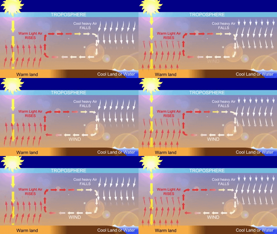
What’s more, as the hot air rises in the atmosphere, it will eventually cool down. As a result, the air molecules will come together more closely, causing the gas to contract and sink, and leaving behind a high pressure. Once again, cold gas rushes into the warmed area to replace hot gas, ending the cycle. This is called a convection current.
This physics explains why we feel a cool breeze at midday at the beach. The ground is a lot hotter than the sea. This temperature difference then drives the cold air above the sea towards the hot area above the ground.
So, you see, what ultimately causes the wind is the Sun.
How the wind drives storms
Most winds are caused by fairly small differences in air pressure. Gentle winds you might feel on a spring day are usually the result of a difference in air pressure of about 1% across several large regions.
However, when the air pressure difference is greater than 10% over a very small area, very dangerous and violent winds can form, such as those encountered in a tornado.
When energy and wind are released, they can either burst into a straight line or spiral. Some of the most common types of wind storms include derechos, bow echoes, and microbursts. Tornadoes and tropical cyclones are considered wind-driven events, and unlike straight-line winds from downbursts, these winds spin like a top.
Here’s some interesting stats you might find relevant the next time you hear wind speed mentioned in the weather report. At 25-30 mph, large branches sway and umbrellas are difficult to control. At 32 mph, you can see entire trees swinging. At around 40 mph, the wind is so strong you’ll feel a lot of resistance while walking in the direction of the gust; small branches may get blown off trees, so now’s the time to be extra careful. At 55 mph, storm winds are strong enough to uproot trees and cause structural damage.

The fastest wind speed was measured in 1999 inside a tornado by a doppler radar that clocked in a staggering 300 mph. The fastest wind measured outside a tornado was 253 mph during Tropical Cyclone Olivia in 1996.
Wind speed and wind energy
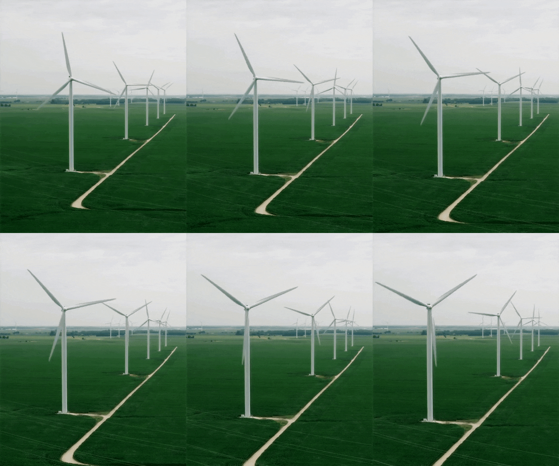
Solar panels are a great way to directly convert solar energy into electricity that we can use to power our homes and gadgets. But, there’s a tremendous amount of energy that we can harness from the sun indirectly, by using turbines to capture some of that wind energy.
The faster the wind, the greater its kinetic energy. And wind turbines with a larger surface area will capture more wind and produce more power. These two parameters together can be tweaked to produce phenomenal amounts of energy. How so?
Well, kinetic energy is proportional to mass times velocity squared. When speaking about wind, its mass refers to that of the air molecules. So when you double wind speed, its kinetic energy is actually four times greater. However, when wind speed doubles, so does the amount of air pushing the turbine’s blades.
So, every time wind speed doubles, the amount of energy hitting the turbine actually increases 8-fold. This is why wind-rich countries can do so well with wind energy. Denmark, for instance, sourced 47% of its power usage in 2019 from wind energy. Similarly, Ireland sourced 28% of its domestic power demand from wind in 2018.


