When you’re looking at the sky, do you ever wonder about the vast, sprawling grey blankets that cast a shadow over the day? Those are called Nimbostratus clouds, and they carry a tale of our atmosphere that you can unravel.
What is a Nimbostratus Cloud?

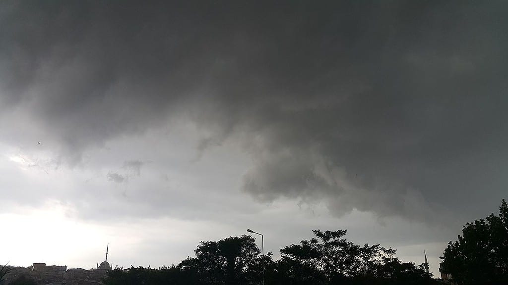
Nimbostratus clouds are low-level, thick, and grey clouds that stretch wide across the sky. Their ominous presence usually means you’re in for an extended period of light to moderate rain or snow, rarely accompanied by thunderstorms.
Nimbostratus doesn’t offer the picturesque fluffiness that some other cloud types do – it’s more about function than form.
How do Nimbostratus Clouds Form?
Nimbostratus clouds typically form when warm, moist air rises and condenses at a low altitude. This process often occurs ahead of a warm or occluded front in the atmosphere. As the warm air ascends, it cools, and the water vapor within it condenses into tiny water droplets or ice crystals, forming the extensive, gray cloud layer we see as nimbostratus.
Identifying Nimbostratus Clouds

Spotting nimbostratus clouds isn’t too challenging, as they have distinctive features that set them apart from other cloud types. Look for the following clues to identify nimbostratus clouds in the sky:
- Uniform Gray Layer: Nimbostratus clouds cover the sky in a continuous, dull gray layer without any significant breaks or variations in texture.
- No Well-Defined Edges: Unlike cumulus clouds with their clearly defined edges, nimbostratus clouds have a blurred and hazy appearance at their boundaries.
- Precipitation: Nimbostratus clouds are precipitation-bearing clouds. If you see a dark, gray layer accompanied by steady rain or snowfall, you’re likely looking at nimbostratus clouds.
Weather Prediction
Nimbostratus clouds are often associated with steady, continuous precipitation, making them reliable indicators of certain weather conditions. When you spot nimbostratus clouds approaching, you can expect the following weather outcomes:
- Rain or Snow: Nimbostratus clouds usually bring moderate to heavy rain or snow, lasting for an extended period. The intensity of precipitation may vary, but it’s generally not as intense as that associated with thunderstorms.
- Overcast Skies: Nimbostratus clouds cover the entire sky, leaving no room for sunlight to break through. Prepare for a gloomy and dim day ahead.
Subtypes of Nimbostratus
There are two main subtypes of Nimbostratus clouds: Nimbostratus pannus and Nimbostratus praecipitatio.
- Nimbostratus pannus are accompanied by lower clouds known as scud clouds. They appear ragged as they are torn by the wind.
- Nimbostratus praecipitatio are Nimbostratus clouds from which precipitation is reaching the ground. This is the type of Nimbostratus we see most often.
So next time you look at the sky and see a vast layer of grey, remember it’s more than just a rain bringer; it’s a Nimbostratus cloud telling you a tale of the atmosphere’s movements. And while it might not be the most picturesque cloud, it plays a vital role in our weather system.
FAQ about Nimbostratus Clouds
Typically, Nimbostratus clouds are not associated with severe weather like tornadoes or severe thunderstorms. They are linked with steady rain or snow.
Yes, although it might be more challenging. The clouds will still block out starlight and moonlight, creating a dark sky.
No, they can form in any season, given the right conditions. They are, however, more common in winter and during transitional seasons like spring and fall.


