Before they can understand how our planet’s climate is changing, scientists first need to understand the basic principles of this complicated system — the gears that keep the Earth’s climate turning. You can make simple models with simple interactions, and this is what happened in the first part of the 20th century. But starting from the 1950s and 1960s, researchers started increasingly incorporating more complex components into their models, using the ever-increasing computing power.
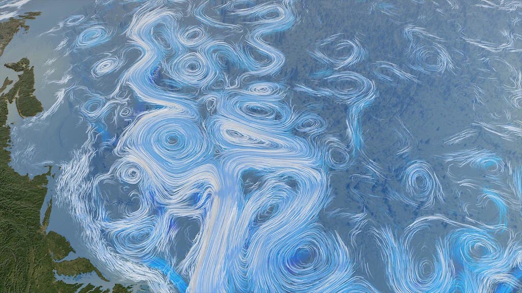
But the more researchers looked at climate (and the atmosphere, in particular), the more they understood that not everything is neat and ordered. Many things are predictable — if you know the state of the system today, you can calculate what it will be like tomorrow with perfect precision. But some components are seemingly chaotic.
Chaos theory studies these well-determined systems and attempts to describe their inner workings and patterns. Chaos theory states that behind the apparent randomness of such systems, there are interconnected mechanisms and self-organization that can be studied. So-called chaotic systems are very sensitive to their initial conditions. In mathematics (and especially in dynamic systems), the initial conditions are the “seed” values that describe a system. Even very small variations in the conditions today can have major consequences in the future.
It’s a lot to get your head around, but if you want to truly study the planet’s climate, this is what you have to get into.
The Butterfly Effect
Edward Lorenz and Ellen Fetter are two of the pioneers of chaos theory. These “heroes of chaos” used a big noisy computer called LGP-30 to develop what we know as chaos theory today.
Lorenz used the computer to run a weather simulation. After a while, he wanted to run the results again, but he just wanted half of the results, so he started the calculations using the results from the previous run as an initial condition. The computer was running everything with six digits, but the results printed were rounded to 3 digits. When the calculations were complete, the result was completely different from the previous one.
That incident resulted in huge changes for the fields of meteorology, social sciences and even pandemic strategies. A famous phrase often used to describe this type of situation is “the butterfly effect”. You may be familiar with the idea behind it: “The flap of a butterfly’s wings in Brazil can set off a Tornado in Texas”. This summarizes the whole idea behind the small change in the initial conditions, and how small shifts in seemingly chaotic systems can lead to big changes.

To get the idea, Lorenz went on to construct a diagram that depicts this chaos. It is called the Lorenz Attractor, and basically, it displays the trajectory of a particle described by a simple set of equations. The particle starts from a point and spirals around a critical point — a chaotic system is not cyclical so it never returns to the original point. After a while, it exceeds some distance and starts spiraling around another critical point, forming the shape of a butterfly.
Why is it chaotic?
If the atmosphere is chaotic, how can we make predictions about it? First, let’s clarify two things. Predicting the weather is totally different from predicting the climate. Climate is a long period of atmospheric events, on the scale of decades, centuries, or even more. The weather is what we experience within hours, days, or weeks.
Weather forecasting is based on forecast models which focus on predicting conditions for a few days. To make a forecast for tomorrow, the models need today’s observations as the initial condition. The observations aren’t perfect due to small deviations from reality but have improved substantially due to increases in computation power and satellites.
However, fluctuations contribute to making things harder to predict because of chaos. There is a limit to when the predictions are accurate — typically, no more than a few days. Anything longer than that makes the predictions not trustworthy.
Thankfully, our knowledge about the atmosphere and technological advances made predictions better compared to 30 years ago. Unfortunately, there are still uncertainties due to the chaotic atmospheric behavior. This is illustrated in the image below, the model’s efficiency is compared between the day’s ranges. The 3-day forecast is always more accurate, compared to predictions from 5 to 10 days.

This image also shows an interesting societal issue. The Northern Hemisphere has always been better at predicting the weather than the South.
This happens because this region contains a larger number of richer countries that developed advanced science and technology earlier than the Global South, and have more monitoring stations in operation. Consequently, they used to have many more resources for observing the weather than poorer countries. Without these observations, you don’t have initial conditions to use for comparison and modeling. This started to change around the late ’90s and early 2000s when space agencies launched weather satellites that observe a larger area of the planet.
Predicting the climate
Predicting the climate is a different challenge, and in some ways, is surprisingly easier than predicting the weather. A longer period of time means more statistical predictability added to the problem. Take a game of chance, for instance. If you throw dice once and try to guess what you’ll get, the odds are stacked against you. But throw a dice a million times, and you have a pretty good idea what you’ll get. Similarly, when it comes to climate, a bunch of events are connected on average to long-term conditions and taken together, may be easier to predict.
In terms of models, there are many different aspects of weather and climate models. Weather models can predict where and when an atmospheric event happens. Climate models don’t focus on where exactly something will happen, but they care how many events happen on average in a specific period.
When it comes to climate, the Lorenz Attractor is the average of the underlying system conditions — the wings of the butterfly as a whole. Scientists use an ensemble of smaller models to ‘fill the butterfly’ with possibilities that on average represent a possible outcome, and figure out how the system as a whole is likely to evolve. That’s why climate models predictions and projections like those from the IPCC are extremely reliable, even when dealing with a complex, seemingly chaotic system.
Comparing models
Today, climate scientists have the computer power to average a bunch of models trying to predict the same climate pattern, further finessing the results. They can also carry out simulations with the same model, changing the initial conditions slightly and averaging the results. This provides a good indicator of what could happen for each outcome. Even further than that, there is a comparative workforce between the scientific community to show that independent models from independent science groups are agreeing about the effects of the climate crisis.
Organized in 1995, the Coupled Model Intercomparison Project (CMIP) is a way of analysing different models. This workforce makes sure scientists are comparing the same scenario but with different details in the calculations. With many results pointing to a similar outcome, the simulations are even more reliable.

Ultimately, predicting the climate is not like we are going to predict if it will be rainy on January 27 2122. Climate predictions focus on the average conditions that a particular season of an oscillatory event will be like. Despite the chaotic nature of the atmosphere, thanks to climate’s time length and statistical predictability, long-term climate predictions can be reliably made.


