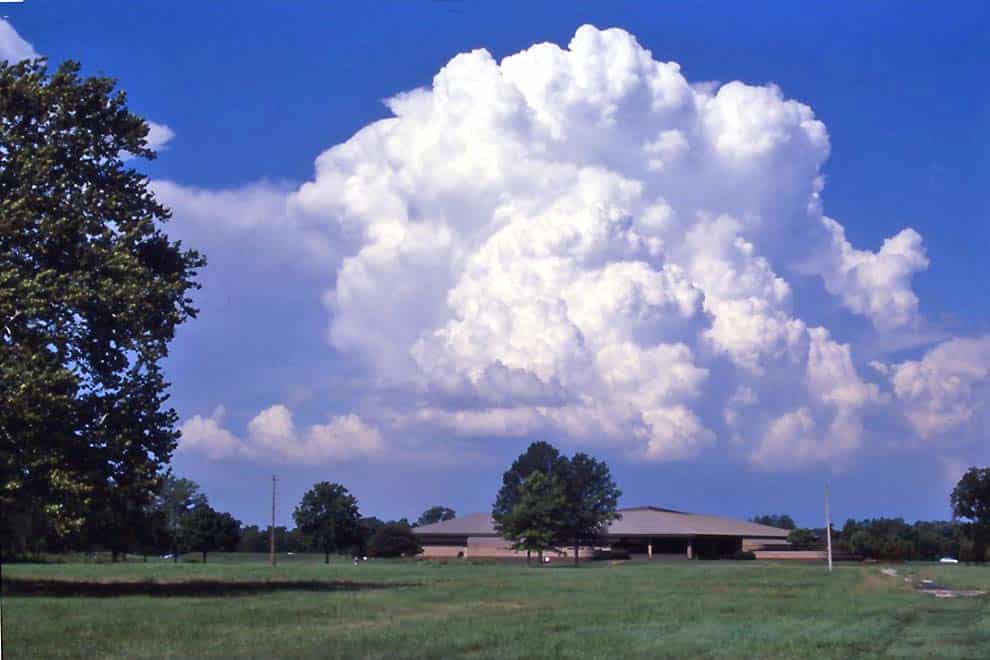
When you gaze skyward, you may spot a collection of fluffy, white clouds with well-defined edges, resembling cotton balls or floating castles. These are cumulus clouds, one of the most common and fascinating cloud types you can observe. Understanding these clouds not only allows you to appreciate the beauty of nature but also provides valuable insights into atmospheric conditions and weather changes.
What Are Cumulus Clouds?

Cumulus clouds are low-level clouds characterized by their distinct puffy, cauliflower-like appearance. These clouds form due to localized convection, the process by which warm, moist air rises, cools, and condenses into visible water droplets or ice crystals.
The name “cumulus” comes from the Latin word for “heap” or “pile,” aptly describing their voluminous and billowing appearance.
How Do Cumulus Clouds Form?
Cumulus clouds usually form in fair weather conditions, driven by the sun’s heating of the Earth’s surface. As the sun warms the ground, the air above it also heats up, becoming buoyant and rising.
As the warm air rises, it cools, and its moisture condenses into tiny water droplets, creating the visible cloud. This process is like watching a bubbling cauldron of water vapor rising from the surface, transforming into the magnificent cumulus clouds we see above.
How to Identify Cumulus Clouds

Identifying cumulus clouds is relatively simple, as they exhibit some distinctive features:
- Puffy Appearance: Cumulus clouds have a fluffy, cotton-like appearance, with well-defined edges and a distinct separation from the surrounding sky.
- Vertical Development: These clouds often grow upwards, reaching impressive heights and forming shapes reminiscent of castles or mountains.
- White Color: Cumulus clouds are generally bright white, especially when illuminated by the sun.
- Individual Cloud Units: They are typically separated, appearing as individual cloud units rather than a continuous layer.
Weather Prediction Using Cumulus Clouds
Cumulus clouds play a crucial role in weather prediction, particularly in short-term forecasting. Observing changes in their size, shape, and movement can provide valuable insights into atmospheric conditions. Here’s what you can deduce from different cumulus cloud characteristics:
- Fair Weather: Small, isolated cumulus clouds with minimal vertical development generally indicate fair and stable weather conditions.
- Potential Storms: Larger, towering cumulus clouds with significant vertical development suggest atmospheric instability and the possibility of thunderstorms later in the day.
Subtypes of Cumulus Clouds

Cumulus clouds come in various subtypes, each with its unique characteristics. Some of the common subtypes include:
- Cumulus Humilis: These are small, flat-based cumulus clouds with limited vertical growth, often associated with fair weather conditions.
- Cumulus Congestus: Also known as towering cumulus clouds, these have significant vertical development, indicating potential thunderstorm development.
- Cumulus Radiatus: This subtype forms when cumulus clouds appear in parallel rows, often resembling a field of clouds and indicating stable atmospheric conditions.
FAQ about Cumulus Clouds
Cumulus clouds themselves do not produce rain. However, if they continue to grow and develop into cumulonimbus clouds, they can lead to rain, thunderstorms, or even severe weather.
Cumulus clouds primarily form during the day when the sun’s heating is most intense. However, in certain atmospheric conditions, cumulus clouds can persist or form at night, although they are less common.
Yes, there are several cloud types, including stratus, cirrus, nimbostratus, and cumulonimbus clouds, each with its unique characteristics and weather implications.
Cumulus clouds can dissipate when the warm, moist air stops rising, and the cloud’s water droplets evaporate. They can also merge and grow into larger cloud systems.
While cumulus clouds can provide valuable insights into short-term weather changes, professional weather forecasting involves various data sources and models to provide accurate and reliable predictions.


