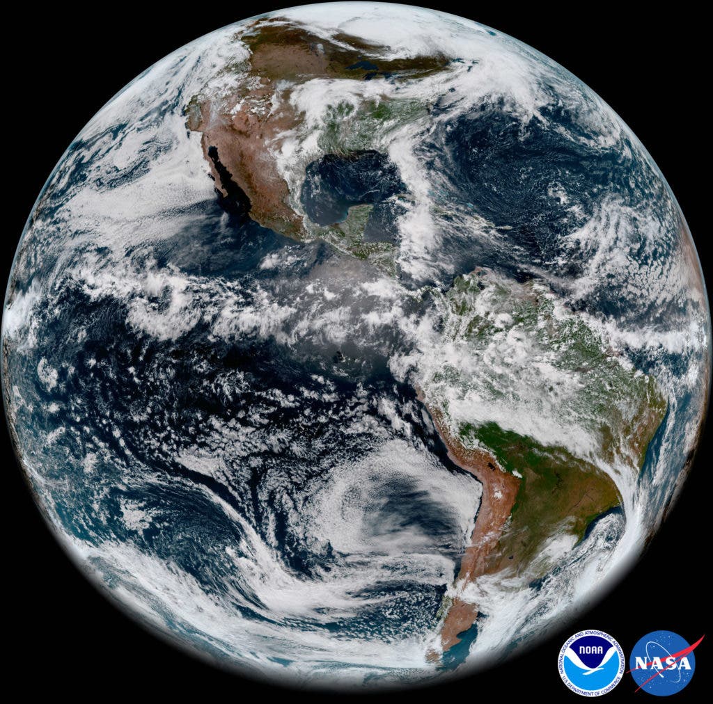
Three months after its launch, NOAA’s newest weather satellite recently beamed back the first videos and pictures of the dear, blue marble we call home. Although the satellite is unfortunately plagued by technical difficulties that keep it from operating at its full potential, this didn’t steal any of the pictures’ charm.
The new satellite called GOES-17, joined GOES-16, another NOAA weather satellite, as a pair that scans the Western Hemisphere from the coast of Africa all the way to New Zealand. Together, the two satellites are meant to use their state-of-the-art instruments to monitor everything from droughts to hurricanes.
The ABI on GOES-17 detects smoke plumes as shown in this imagery of wildfires in central and northern Saskatchewan, Canada, observed on May 20, 2018.
The latest snapshots shown here were taken by GOES-17’s Advanced Baseline Imager (ABI), which scans Earth in 16 spectral bands, such as visible, infrared, and near-infrared channels. Infrared is particularly important since it allows scientists to image weather phenomena such as cloud formation or water vapor content even during the night when there isn’t any light reflected by the clouds.
Unfortunately, GOES-17 is going through a rough patch — it can’t keep itself cool enough for its instruments to function at full power. Among other things, this means that GOES-17 can’t employ its infrared capabilities at any time. The satellite has to actively vent off heat for the instrument to function, and infrared wavelengths can only be picked up if the sensor is below 60K (-213°C, or -350°F). Currently, the cooling system can only maintain such temperatures for 12 hours a day at best.
For today’s images, the visible spectrum was combined with ABI’s “longwave” infrared bands, which were functional during a portion of the day despite the cooling system issue. This is how these vivid, so-called ‘GeoColor’ images could be taken.
These dynamic marine stratocumulus cloud patterns off the western coast of Chile in the southeastern Pacific Ocean are revealed by the ABI.
The footage was taken on 20 May from a distance of about 22,300 miles above the equator, and publically released today on NOAA’s website.
GOES-17 ABI captured a deck of low level stratus clouds covering the southern California coast.
The satellite is still in its testing phase and shouldn’t become fully operational until the end of this year. If the cooling system can’t be fixed by then, NOAA will look for alternative modes of operation to maximize the utility of ABI.


