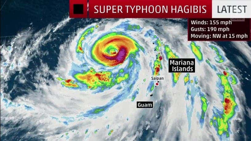
Currently the strongest storm on the planet and on its way to possibly becoming the strongest of the year, Super Typhoon Hagibis has already gathered strength with astonishing speed. Winds surged at over 144 km/h (90 mph), and it took just 18 hours for Hagibis to reach super typhoon status.

The U.S. National Weather Service issued a typhoon warning for the islands of Saipan, Tinian, Alamagan and Pagan in the Northern Marianas, with the worst impacts from the storm expected soon in the region. A tropical storm warning was also in effect for the islands of Agrihan, Rota, and Guam.
Hagibis is set to bring strong winds and torrential rainfall to the Northern Marianas, a U.S. territory in the North Pacific. Flash flooding and high surf are also likely in Guam as the center of the storm moves towards the north. From there, models diverge somewhat on the eventual path of the storm, but the official track takes it on a path close to Japan’s northern islands.
This means Hagibis could also affect the Rugby World Cup, currently held in Japan. The World Rugby Federation has said they are monitoring the situation in the hope Hagibis does not prove to be a danger to World Cup fixtures and training sessions. A World Rugby spokesperson said:
“We are currently monitoring the development of a typhoon off the south coast of Japan in partnership with our weather information experts. It is still too early to determine what, if any, impact there will be on match or training activities.”
Hagibis’ tiny circulation took advantage of plentiful warm ocean water, low wind shear and winds aloft that were spreading apart from its core — tropical cyclones with small inner cores of convection are notorious for rapidly developing and weakening much faster than expected.
Hagibis became the fourth Category 5 tropical cyclone on Earth in 2019, according to Philip Klotzbach, a hurricane researcher at Colorado State University — following Super Typhoon Wutip in February, Dorian in early September and Lorenzo in late September.
“This is the most intensification by a tropical cyclone in the western North Pacific in 18 hours since Yates in 1996,” Klotzbach said.
Hagibis joined an impressive list of Atlantic hurricanes that rapidly intensified since 2017, including Harvey, Irma, Maria, Florence, Michael, and Lorenzo. Rapid intensification is a tropical cyclone is defined as an increase in wind speed of at least 35 mph in 24 hours — it’s very unusual for a storm to develop so quickly, but the process seems to become more common in recent years. The most likely culprit for this is climate change.
Extreme hurricane intensification such as what we just witnessed with Hagibis could further increase in the future from climate change, according to recent research from Kerry Emanuel, a hurricane scientist working at MIT.
“Rates of intensification increase more rapidly than intensity itself as the climate warms, so that rapidly intensifying storms like Michael may be expected to become more common,” said Emanuel.


